 |
|
|
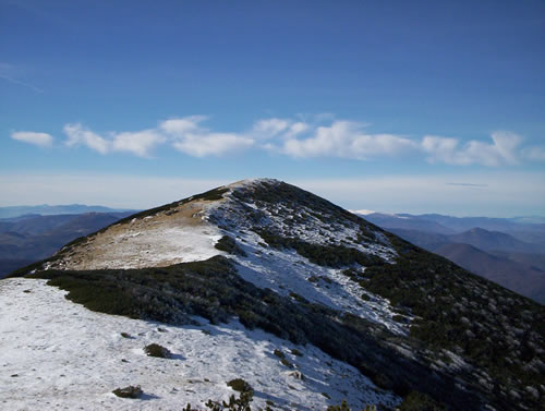
 Hranisava summit Hranisava summit
|
| Max altitude : | 1964 m | |
| Total denivelation : | 855 m | |
| Total distance : | 10500 m | |
| Trekking time : | 5h | |
| Landscape beauty : |  | |
| Physical difficulty : | | |
| Orientation marks : | | |
| Mine risk : | - | |
| Orientation map : |  | |
| Denivelation map : | 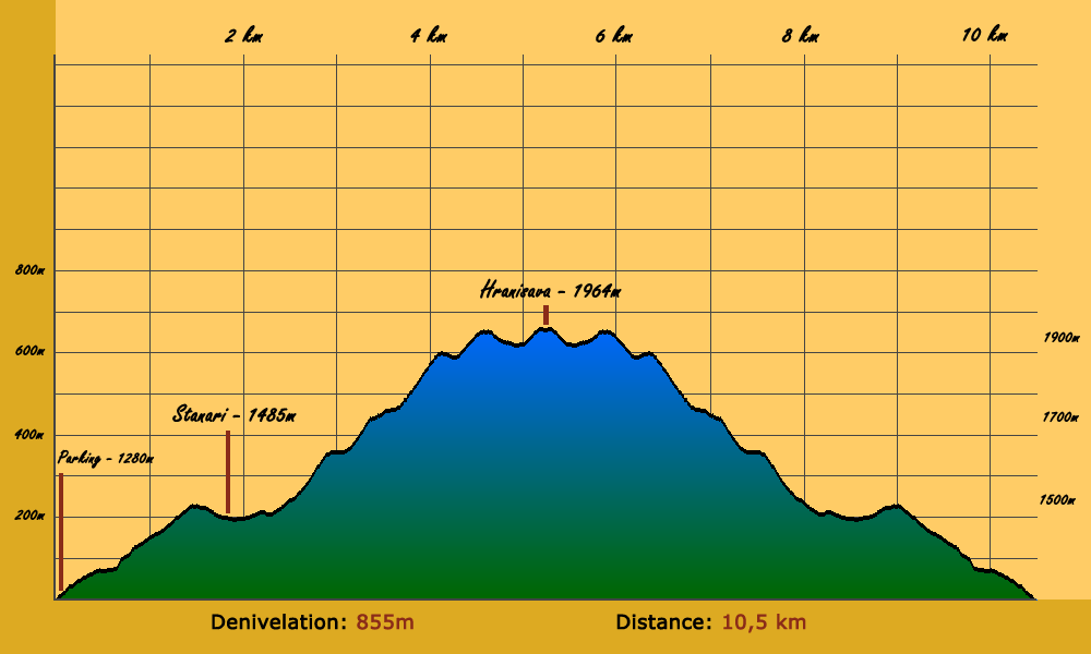 | |
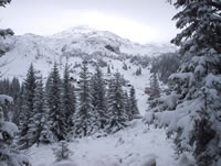
One of the best hike of the Bjelasnica mountain ranges. The summit give a 360° view: a wonderful panorama. |
 To go at the departure of this hike, you have to go to a little village called Lokve, passing by Zovik. Zovik is situated after Hadzici when you come from Sarajevo, you will have to make a left turn 4km after Hadzici, the road is difficult to see because not indicated, but 50m meters before the left turn, you will be able to see a bar called Zovik, this is your clue. To go at the departure of this hike, you have to go to a little village called Lokve, passing by Zovik. Zovik is situated after Hadzici when you come from Sarajevo, you will have to make a left turn 4km after Hadzici, the road is difficult to see because not indicated, but 50m meters before the left turn, you will be able to see a bar called Zovik, this is your clue.
|
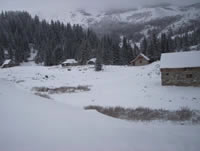
One time you reach Lokve, make a right turn just before the mosque, you have to continue 9 km using a dirt road, you will arrive to a large parking marked "Salihagina Bajta".
|
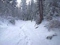
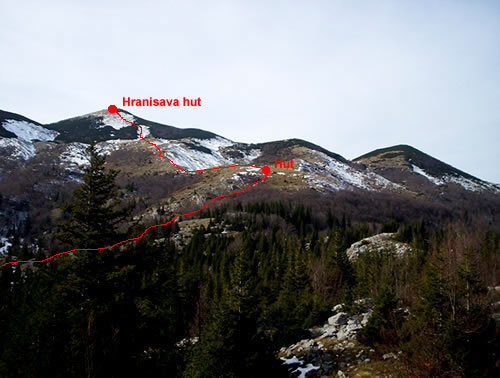
To go until Hranisava summit, you have to reach first the Stanari hut. To reach this point, you will pass through a forest, the way until Stanari is well indicated.
|
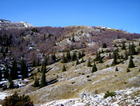
You will arrive above the forest, you have choice to continue by this path going directly to the stanari hut or to continue your hike to Hranisava. You don't really need to reach the Stanari hut : you can go directly in the village, and find a way to go to the west direction, the path is easy to see:
|
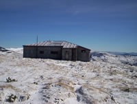
First step, is to reach a hut around 1640m, you will probably need around 1 hour to arrive there (walking slowy), you have to pass through a small forest, the way is well indicated as soon as you find the hike path. But even if you don't find the hike path, you just go to the west direction and you will quickly reach the hut.
|
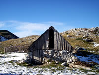
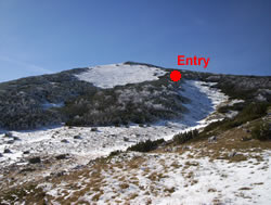
The second step is to reach the Hranisava hut (1953m), the path is easy to find until there, the only difficulty is to find the entry 200-300m before the hut, you have some small trees blocking the access, but you have a marked way, just be carefull to see the marks (especially during winter).
|
You are not at the summit yet, you should walk 30 minutes to the west direction. The hike path is sometimes difficult to see during winter, just be sure to go strictly west and you should find the summit.
|
|
|
|