 |
|
|
 Bjelasnica summit Bjelasnica summit
|
| Max altitude : | 2067 m | |
| Total denivelation : | 900 m | |
| Total distance : | 11300 m | |
| Trekking time : | 4h | |
| Landscape beauty : |  | |
| Physical difficulty : | | |
| Orientation marks : | | |
| Mine risk : | | |
| Orientation map : | 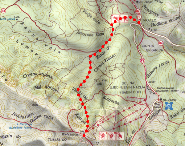 | |
| Denivelation map : | 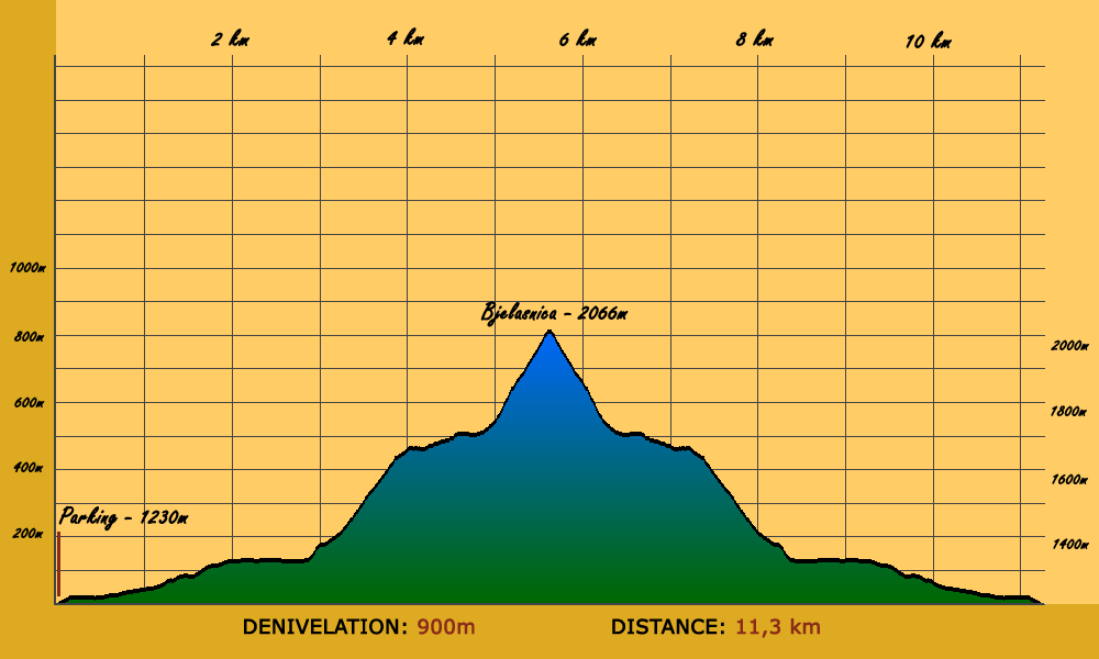 | |
This trekking is probably one of the most famous in Bosnia, but not an easy one : it's better to be in good shape to make it. |
 The hike start in Igman, next to the police academy, you can park easily your car by there. The hike start in Igman, next to the police academy, you can park easily your car by there. |
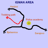 | The way to take is not difficult to find, it's just next to the police academy : 50 meters in direction of Hadzici city, at the left you have a dirt road that you can take with a car (The GPS position is approximately 43,73765/18,27935).
You have to continue on this road during some kilometers until a sign indicating the way for the Bjelasnica summit. At this point, you will need around 2h to reach the summit. |
You will start to increase :-) The path is well marked and you should have no problem to follow it. |
After maybe 45 minutes, you will come out of the forest, reaching an open grassland.
|
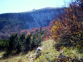
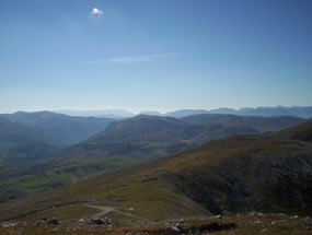
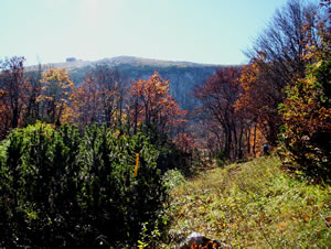 | As you can see, the summit is closer ! But you still need 1h-1h15 (walking slowy).
During the autumn this part of the hike is probably the best ! Open grassland with colored trees, bjelasnica summit in background, awesome... |
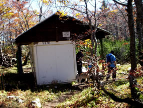
Just after you ride a new slope in the open grassland, you will enter in a small forest and find a house in your left, you can seat outside just in front of Bjelasnica summit.
|
Continue to follow the well marked path, you will arrive soon until a steep slope with rocks and small trees, take care, especially if the floor is wet. |
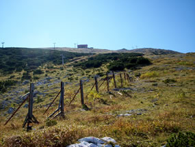
After 20-30 minutes, you will reach a large open grassland with a good visibility until the summit, it's the last step and probably the worst ! You will need 30-45 more minutes to reach the summit.
|
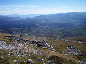
The best reward is the wonderful view, especially if you watch to the side of the "Dugo Polje" valley (west side).
|
Take a good break, but don't forget the time, you have to come back :-) especially during autumn and winter : the night is coming very quickly.
|
|
|
|