 |
|
|
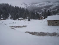
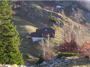
 "Stanari" hut "Stanari" hut
|
| Max altitude : | 1540 m | |
| Total denivelation : | 270 m | |
| Total distance : | 3630 m | |
| Trekking time : | 1h30 | |
| Landscape beauty : |  | |
| Physical difficulty : | | |
| Orientation marks : | | |
| Mine risk : | - | |
| Orientation map : | 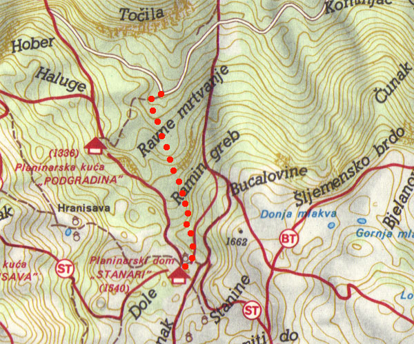 | |
| Denivelation map : | 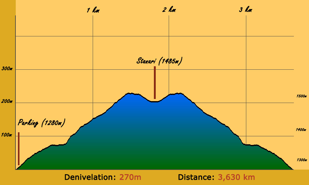 | |
Good for a short hike with friends, you can make a long break at the Stanari house, there you can take some refreshments into a lost village. |
 To go at the departure of this hike, you have to go first to a little village called Lokve, passing by Zovik. Zovik is situated after Hadzici when you come from Sarajevo, you will have to make a left turn 4km after Hadzici, the road is difficult to see because not indicated, but 50m meters before the left turn, you will be able to see a bar called Zovik, this is your clue. To go at the departure of this hike, you have to go first to a little village called Lokve, passing by Zovik. Zovik is situated after Hadzici when you come from Sarajevo, you will have to make a left turn 4km after Hadzici, the road is difficult to see because not indicated, but 50m meters before the left turn, you will be able to see a bar called Zovik, this is your clue.
|
One time you reach Lokve, make a right turn just before the mosque, you have to continue 9 km using a dirt road, you will arrive to a large parking marked "Salihagina Bajta".
|
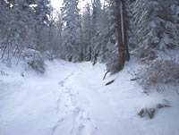
To go until Stanari, you have to pass through a forest, the way until Stanari is well indicated.
|
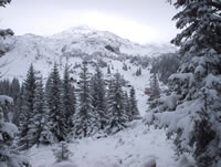
You will arrive above the forest, you have choice to continue by this path going directly to the stanari hut or to go through the village. The Stanari hut is the highest house of the village, you should find it going to the east part of the village.
|
|
|
|